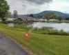
 Tioga State Forest
4 km
Great place for biking, the trail is well maintained. Amazing views of the Pine Creek...
Tioga State Forest
4 km
Great place for biking, the trail is well maintained. Amazing views of the Pine Creek...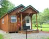 Tanglewood Camping
13 km
Great memories here. Campground is clean and peaceful. Staff are very friendly and he...
Tanglewood Camping
13 km
Great memories here. Campground is clean and peaceful. Staff are very friendly and he...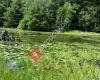 Hills Creek State Park
14 km
Awesome little park. Nice beach and picnic areas. Fishing dock, boat launch and camps...
Hills Creek State Park
14 km
Awesome little park. Nice beach and picnic areas. Fishing dock, boat launch and camps... Packer Park
14 km
A smaller sized park in historic downtown Wellsboro. There are tennis & basketball co...
Packer Park
14 km
A smaller sized park in historic downtown Wellsboro. There are tennis & basketball co... Bucktail Camping Resort
15 km
Great kid oriented camp. Here for their Halloween weekend and they've had the kids ru...
Bucktail Camping Resort
15 km
Great kid oriented camp. Here for their Halloween weekend and they've had the kids ru...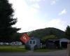 Twin Streams Campground
15 km
This campground was one of the best campsites my wife and I have ever had the pleasur...
Twin Streams Campground
15 km
This campground was one of the best campsites my wife and I have ever had the pleasur...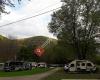 Stony Fork Creek Campground
19 km
Great place. Located in the valley at the Grand canyon of PA. Family owned property. ...
Stony Fork Creek Campground
19 km
Great place. Located in the valley at the Grand canyon of PA. Family owned property. ... Tioga County Visitors Bureau
19 km
Super friendly and extremely helpful. Knew a lot about tioga and potter counties.
Tioga County Visitors Bureau
19 km
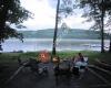
Super friendly and extremely helpful. Knew a lot about tioga and potter counties.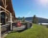 Tioga-Hammond Lakes Recreation Area
22 km
Excellent for camping and boating. Easy to get to. Has life long boat passes for seni...
Tioga-Hammond Lakes Recreation Area
22 km
Excellent for camping and boating. Easy to get to. Has life long boat passes for seni...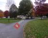 Ives Run Campground
23 km
I've been to this Park several times. The first time was to hike the trails and go to...
Ives Run Campground
23 km
I've been to this Park several times. The first time was to hike the trails and go to...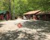 Canyon Country Campground
24 km
Great secluded campground within walking distance of the canyon and a short drive fro...
Canyon Country Campground
24 km
Great secluded campground within walking distance of the canyon and a short drive fro...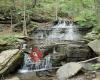 Leonard Harrison State Park
25 km
Spectacular views of the canyon. There is a one mile walking trail to the bottom on t...
Leonard Harrison State Park
25 km
Spectacular views of the canyon. There is a one mile walking trail to the bottom on t... Colton Point State Park
26 km
The camping here was great. The camping area was quiet. A short walk from the campsit...
Colton Point State Park
26 km
The camping here was great. The camping area was quiet. A short walk from the campsit...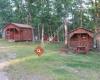 Scenic View Campground LLC
27 km
Beautiful view from our campsite it also has a restroom and showers and a small store...
Scenic View Campground LLC
27 km
Beautiful view from our campsite it also has a restroom and showers and a small store... Fred's Lobster Garden
28 km
Fred's Lobster Garden
28 km
 Tompkins Campground
33 km
Great campground with amazing views of the lake. Sites are very spacious and clean. R...
Tompkins Campground
33 km
Great campground with amazing views of the lake. Sites are very spacious and clean. R...to add Sand Run Falls map to your website;