 SAIT / AUArts / Jubilee
539 miles
Station to get into three educational institutes, typically full of students
SAIT / AUArts / Jubilee
539 miles
Station to get into three educational institutes, typically full of students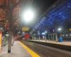 Downtown West–Kerby
1 km
The end of the free fare zone. You need to hold a valid ticket to travel further to 6...
Downtown West–Kerby
1 km
The end of the free fare zone. You need to hold a valid ticket to travel further to 6...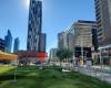 8th Street SW
1 km
the moxies nearby gives off a nice evening atmosphere when they play music, nice bask...
8th Street SW
1 km
the moxies nearby gives off a nice evening atmosphere when they play music, nice bask...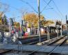 Lions Park
2 km
Closest stop for the North Hill Centre, which has most stores. Has good seating arran...
Lions Park
2 km
Closest stop for the North Hill Centre, which has most stores. Has good seating arran...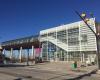 Sunalta Station
2 km
Relatively neat, not too rowdy. There's sometimes homeless people hanging around for ...
Sunalta Station
2 km
Relatively neat, not too rowdy. There's sometimes homeless people hanging around for ...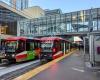 WB City Hall/Bow Valley College(TD Free Fare...
2 km
I mean. What can I say. It’s filthy and people are harassed and or abused. I had to k...
WB City Hall/Bow Valley College(TD Free Fare...
2 km
I mean. What can I say. It’s filthy and people are harassed and or abused. I had to k...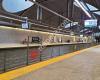 EB Westbrook CTrain Station
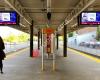
4 km
The station is very clean and elevators and escalators are working perfectly. Even so...
EB Westbrook CTrain Station
4 km
The station is very clean and elevators and escalators are working perfectly. Even so...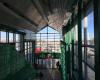 Franklin
6 km
Its the LRT station that goes to Forest Lawn. That should tell you all you need to kn...
Franklin
6 km
Its the LRT station that goes to Forest Lawn. That should tell you all you need to kn...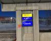 Chinook Station
7 km
One of the nicer train stations in calgary. There's heated seating that turns on when...
Chinook Station
7 km
One of the nicer train stations in calgary. There's heated seating that turns on when...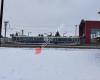 Rundle Station
7 km
The place has to be climbed up and down unlike the Whitehorn station where you can ju...
Rundle Station
7 km
The place has to be climbed up and down unlike the Whitehorn station where you can ju...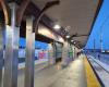 SB Fish Creek - Lacombe CTrain Station
15 km
It was very clean no garbage around, it was not very busy, there is construction goin...
SB Fish Creek - Lacombe CTrain Station
15 km
It was very clean no garbage around, it was not very busy, there is construction goin...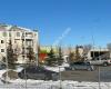 SB Somerset - Bridlewood CTrain Station
18 km
south end of the red line, there's a tim hortons and wendys within 1 minute's walk, a...
SB Somerset - Bridlewood CTrain Station
18 km
south end of the red line, there's a tim hortons and wendys within 1 minute's walk, a...to add Sunnyside map to your website;