The U.S. Forest Service Facebook page is a combined effort of the National Forest Foundation and the USDA Forest Service.
The National Forest Foundation, chartered by Congress, engages Americans in community-based and national programs that promote the health and public enjoyment of the 193-million -acre National Forest System, administers private gifts of funds and land for the benefit of the National Forests. http://www.nationalforests.org/.
The Forest Service manages a system of 155 national forests, 20 national grasslands, and 222 research and experimental forests, as well as other special areas, covering more than 192 million acres of public land. The Forest Service has evolved into a 30,000 employee agency that manages the national forests for a number of multiple uses, including recreation, timber, wilderness, minerals, water, grazing, fish, and wildlife.
About the Beaverhead-Deerlodge:
The Beaverhead-Deerlodge National Forest includes an outdoor recreation area encompassing more than 3.3 million acres. Elevations in the forest range from 4,075 ft. in the valleys to 11,361 on Hilgard Peak.
Glaciated peaks rise from broad valleys in the area to form some of Montana’s most majestic ranges—the Anaconda, Bitterroot, Beaverhead, Flint Creek, Gravelly, Highland, Madison, Tobacco Root and Sapphire Ranges. Mountains in these ranges are among the loftiest in the state; more than 40 surpass 10,000 feet. From the snowpack of these ranges spring the Big Hole, Beaverhead and Ruby rivers, which form three major tributaries of the Jefferson River. The high country also supplies some of the tributaries of the Madison River. The Clark Fork River flows from its headwaters west of the Continental Divide to Idaho’s Lake Pend Oreille.
Through this maze of mountains and river valleys Sacagawea led Meriwether Lewis and William Clark in their search for a passage to the Pacific. This was the land of Sacagawea’s people, the Shoshones, who re-provisioned and led the expedition over Lemhi Pass in 1805 and north to a final passage to the West. Despite the inroads of progress—lumbering, mining and ranching—much of the forest’s lands have changed little since Lewis and Clark’s visit.
Within the forest are portions of the Anaconda-Pintler and Lee Metcalf wilderness areas and a large number of roadless tracts. Typical features of roadless areas are glacial lakes, trout streams and rugged mountain vistas. The Anaconda-Pintler Wilderness straddles 30 miles of the Anaconda Range and the Continental Divide. The land gradually rises from dense stands of lodgepole pine to open parks dotted with lakes, culminating in jagged peaks in the heart of the range. Anglers prize the clear mountain streams and alpine lakes for their abundance and variety of trout.
Another major area is the Tylor-Hilgard portion of the Lee Metcalf Wilderness. This unit is one of the four portions of wilderness along the spine of the Madison Range, which lies just northwest of Yellowstone National Park. Soaring peaks, knife-edged ridges and alpine lakes are characteristics of this popular area. Bird-watchers will find more than 260 species frequenting a variety of habitats in the forest. The region provides winter range for bighorn sheep and mountain goats and a home to grizzly and black bears, mule deer, mountain lions, elk and moose.
The bald eagle, formerly on the endangered species list, nests in the southeastern Gravelly Range and winters along the Red Rock, Ruby, Jefferson, Madison, Big Hole and Beaverhead rivers. Most migration and wintering activities occur in the large river valleys adjoining the Forest. The gray wolf is an occasional visitor. Grizzly bears occupy portions of the Forest. Throughout the Forest there is an abundance of elk which constitutes some of the state’s largest herds.
The Forest offers fishing streams, hiking trails, groomed snowmobile trails, developed campgrounds and sits for boating. Fifteen miles west of Anaconda on HWY 1 is Georgetown Lake, one of the area’s busiest recreation sites, partly due to its excellent fishing. Snowmobiling and cross-country and downhill skiing are available at Discovery Basin, north of Georgetown Lake, and at Maverick Mountain near Dillon.
Close to Butte are two large developed recreation sites—Thompson Park which includes several trails suitable for hiking, biking and horseback riding; picnic areas, a Frisbee golf (Folf) course; and Sheepshead Recreation Area includes meadows, forests and a 15-acre lake, paved trails, a picnic area and a fishing pier.
The history of the Forest can be experienced in one of 25 historic ranger stations. Ranging from the tiny 1908 Stony cabin to the modern Gordon Reese log hut, visitors can rent these rustic overnight lodgings as a base to explore the forest.
Detailed information about campgrounds and recreation opportunities is available at the district ranger stations in Butte, Dillon, Ennis, Philipsburg, Sheridan, Whitehall, Wisdom and Wise River. For Further information contact the Beaverhead-Deerlodge National Forest Supervisor’s Office, 420 Barrett Street, Dillon, MT 59725; phone (406) 683-3900 or (406)683-3913 for the Forest’s 24-hour information line; or go online to www.fs.usda.gov/bdnf.
The mission of the USDA Forest Service is to sustain the health, diversity, and productivity of the Nation’s forests and grasslands to meet the needs of present and future generations.
The Forest Service motto, "Caring for the Land and Serving People," captures the spirit of our mission, which we accomplish through five main activities:
- Protection and management of natural resources on National Forest System lands.
- Research on all aspects of forestry, rangeland management, and forest resource utilization.
- Community assistance and cooperation with State and local governments, forest industries, and private landowners to help protect and manage non-Federal forest and associated range and watershed lands to improve conditions in rural areas.
- Achieving and supporting an effective workforce that reflects the full range of diversity of the
American people.
- International assistance in formulating policy and coordinating U.S. support for the protection and sound management of the world's forest resources.
 Southside RV Park
350 miles
This the place that sets an excellent example of what a RV park should look like. We ...
Southside RV Park
350 miles
This the place that sets an excellent example of what a RV park should look like. We ...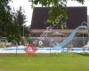 Dillon KOA
2 km
This is the most hospitable and wonderful experience we've had at a KOA. Our hosts Bo...
Dillon KOA
2 km
This is the most hospitable and wonderful experience we've had at a KOA. Our hosts Bo... Countryside RV Park
6 km
Great park with a very friendly staff. The sites are large and easily accommodates ...
Countryside RV Park
6 km
Great park with a very friendly staff. The sites are large and easily accommodates ... Armstead Campground
28 km
We stayed here recently, and the prices are very low, but you get what you pay for. T...
Armstead Campground
28 km
We stayed here recently, and the prices are very low, but you get what you pay for. T...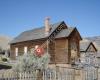 Bannack State Park
28 km
What a great park! We pretty much had the place to ourselves. Staff was friendly, all...
Bannack State Park
28 km
What a great park! We pretty much had the place to ourselves. Staff was friendly, all...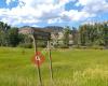 Beaverhead-Deerlodge National Forest
40 km
The national forest is always a great place to take the family to get away from the h...
Beaverhead-Deerlodge National Forest
40 km
The national forest is always a great place to take the family to get away from the h... Price Creek Campground
46 km
Closest campground to Crystal Park. A newer campground with 28 Sites, many are pull-...
Price Creek Campground
46 km
Closest campground to Crystal Park. A newer campground with 28 Sites, many are pull-...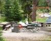 Grasshopper Campground and Picnic Area
46 km
We went to this campground a couple of years ago and it was pristine. The host couple... Reservoir Lake Campground and Picnic Area
64 km
Great place to camp and the fishing is good if you know what you're doing. East Creek Campground
72 km
Grasshopper Campground and Picnic Area
46 km
We went to this campground a couple of years ago and it was pristine. The host couple... Reservoir Lake Campground and Picnic Area
64 km
Great place to camp and the fishing is good if you know what you're doing. East Creek Campground
72 km
 Red Rock Lakes National Wildlife Refuge
95 km
Trumpeter swans in great number were out on the Red Rock Lakes. We had binoculars and...
Red Rock Lakes National Wildlife Refuge
95 km
Trumpeter swans in great number were out on the Red Rock Lakes. We had binoculars and...to add US Forest Service map to your website;