 Purchasing Division
93 miles
Council Bluffs Community Hall
137 miles
Senator Chuck Grassley
203 miles
Visiting Nurse Association
261 miles
Employer Tax Auditor
376 miles
Public Defenders Office
379 miles
Front desk lady needs a new job. She is beyond hateful and need to realize that she i...
Purchasing Division
93 miles
Council Bluffs Community Hall
137 miles
Senator Chuck Grassley
203 miles
Visiting Nurse Association
261 miles
Employer Tax Auditor
376 miles
Public Defenders Office
379 miles
Front desk lady needs a new job. She is beyond hateful and need to realize that she i... IowaWORKS
379 miles
Hershel Reed was very helpful in assisting with filling out the information for my cl... Municipal Housing Agency
379 miles
Council Bluffs Child Support Recovery Unit
383 miles
These people who run this office are sick, they are so quick to take every dime I mak... Iowa Lottery
417 miles
City of Council Bluffs Shop
495 miles
Council Bluffs Traffic Maintenance
529 miles
IowaWORKS
379 miles
Hershel Reed was very helpful in assisting with filling out the information for my cl... Municipal Housing Agency
379 miles
Council Bluffs Child Support Recovery Unit
383 miles
These people who run this office are sick, they are so quick to take every dime I mak... Iowa Lottery
417 miles
City of Council Bluffs Shop
495 miles
Council Bluffs Traffic Maintenance
529 miles
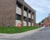
 Driver's License Examiner
3 km
Called here with questions. They were very helpful! They answered all my questions, e...
Driver's License Examiner
3 km
Called here with questions. They were very helpful! They answered all my questions, e...to add Pottawattamie County GIS map to your website;